Beit Shean
Location: Beit Shean
Subject: Gan Eden
Written by: David Magence
Reish Lakish, one of the great Amoraim of Eretz Yisrael (3rd century CE) expressed his opinion that if the Garden of Eden is located within Eretz Yisrael, its entrance is Beit She'an. Reish Lakish's reasoning is the fact that Beit She'an is a very fertile area. Rashi comments that Beit She'an produces the sweetest fruit grown in the Land of Israel. [Gemara Bavli, Mesechet Eruvin 19a]
Beit She'an is an important archeological site, whose major features include: a theater (used for drama and comedy performances), an amphitheater (used for gladiatorial combat), the largest ancient bath house uncovered in Israel and the remains of the main streets, dating to the Roman and Byzantine periods.
Rising above the ruins from these later periods is Tel Beit She'an, the site of Biblical Bet She'an, which yielded no fewer than eighteen separate strata of settlement, over the course of thirty centuries.
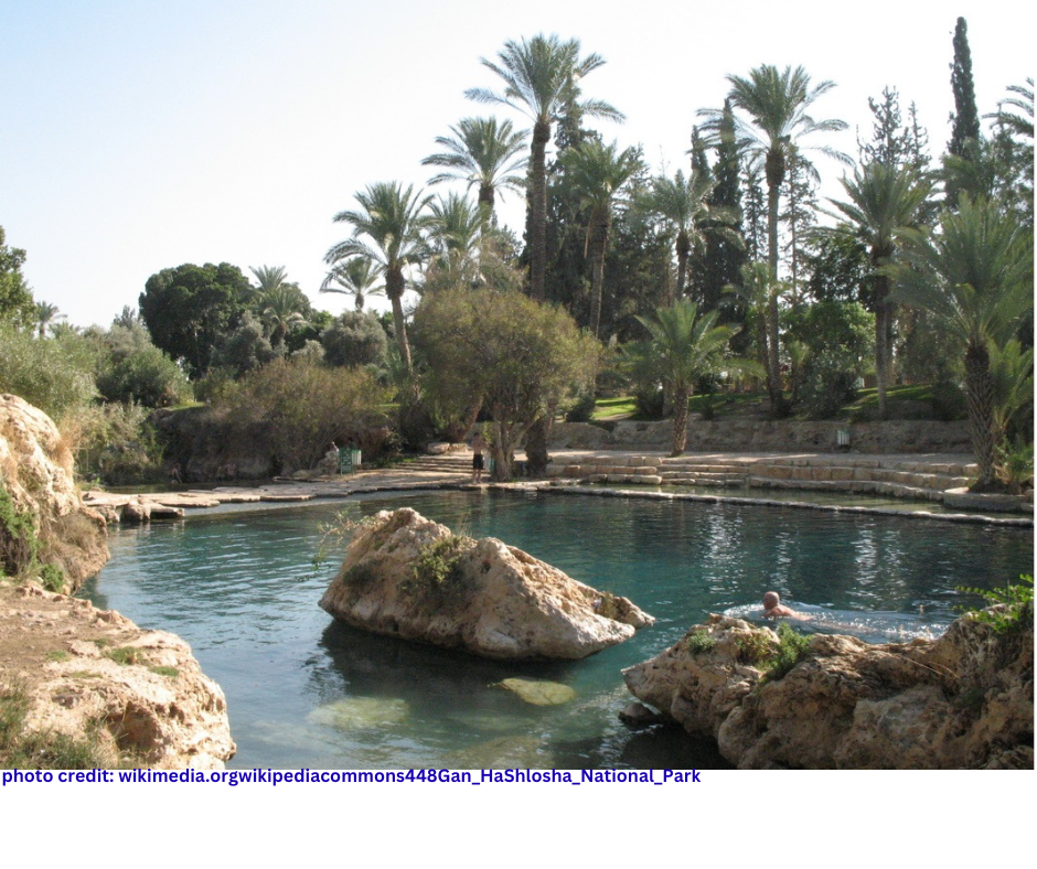
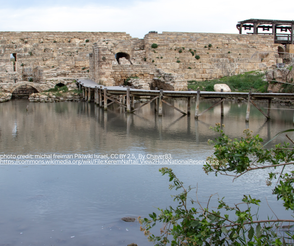
Tiberias
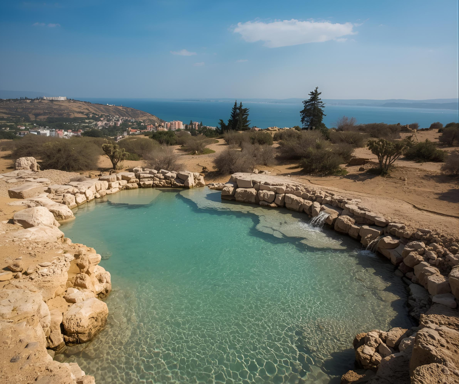
Location: Tiberias
Subject: Tiberias Hot Springs
Written by: David Magence
Rashi quotes our Sages' observation [Bereishit Rabba, 33:4] that at the end of the Flood, not all springs were plugged up, since those which are necessary for the world were not closed. The example presented by the Midrash is the Tiberias Hot Springs.
While there are numerous hot springs within Israel, it is not surprising that the Sages refer specifically to the springs of Tiberias, since they were in the city the Sages lived. Following the defeat of the Bar Kochva revolt (135 CE) the Romans made it a capital crime for a Jew to enter Jerusalem and the vicinity, and the Galil became the center of Jewish life in Israel, with Tiberias being the most important city. In fact, Tiberias was home to the greatest yeshiva of Eretz Yisrael during the Talmudic Period. Thus, our Sages were very familiar with the hot springs at the southern end of Tiberias.
At the Tiberias Hot Springs National Park, one can see (and smell) the water of the hot springs. A highlight of the national park is the remains of an ancient synagogue, with beautiful mosaic floors.
Chevron
Location: Chevron
Subject: Mearat Hamachpela
Written by: David Magence
The pesukim (Bereishit Perek 23 Pesukim 17-19) summarize the negotiations between Avaraham Aveinu and the Hittites for the purchase of Me'arat HaMachpela and its field, which was the first land purchased in Eretz Yisrael by our Forefathers.
The walls around the complex were built more than 2000 years ago, apparently by King Herod. The actual cave is beneath the floor level. There is an entrance to the cave within Ohel Yitzchak, but it is not open, and very few people have actually seen the cave.
Yam Hamelach (Dead Sea)

Location: Yam Hamelach (Dead Sea)
Subject: Yam Hamelach
Written by: David Magence
Sedom and Amora were located along the shore of the Dead Sea. Lot chose Sedom because it was a very fertile area before Hashem destroyed Sedom and Amora. [Breishit Perek 13:Posuk 10]
Three Neviim (Yoel, Yirmiyahu, and Yechezkel) prophesized that in the Final Redemption, water will flow from the Beit Hamikdash to the Dead Sea, turning the water from the saltiest body of water in the world to a fresh water lake, with all kinds of fish flourishing in it and all types of fruit trees growing along its shores. Thus, the Dead Sea area will be returned to its flourishing status prior to the destruction of Sedom and Amora.
Tel Dan (HaGalil)
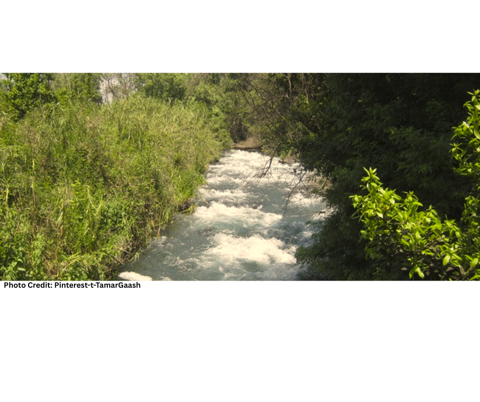
Location: Tel Dan (HaGalil)
Subject: Tel Dan Nature Reserve
Written by: David Magence
In Avraham Avinu's campaign to rescue his nephew Lot, he and his three hundred and eighteen men chased the coalition of four kings to Dan.
At the Tel Dan Nature Reserve, one can see the gate to the city and walk the paths of the nature reserve, whose springs are the largest of the three sources of the Jordan River.
Beit Guvrin

Location: Beit Guvrin
Subject: Yitzchak's Blessing
Written by: David Magence
Midrash Bereishit Rabba [67:6] states that "from the dew of heaven" refer's to Beit Guvrin, which is a very fertile area. In fact, the blessing relates specifically to grain and wine. Approaching Beit Guvrin from the north, one passes wheat fields, and continuing south one passes vineyards, a reality which corresponds to the Midrash.
Within the Beit Guvrin National Park there are approximately 3000 man-made caves. Some were used as olive presses, others as cisterns or granaries, and some were used as hideouts during the Bar Kochva revolt.
Beer Sheva

Location: Beer Sheva
Subject: Tel Sheva
Written by: David Magence
Approximately four kilometers east of modern Beer Sheva, is Tel Be'er Sheva, which some scholars identify as the biblical Beer Sheva. However, the earliest structural remains excavated dates to a period later of that of the Avot.
Perhaps the most interesting find in the excavations was a horned altar. In ancient times, the altar was dismantled and its stones used to build a store house. Based upon the archeologist's dating, it can be assumed that the altar was dismantled as part of the religious reform of KIng Chizkiyahu as related in Tanach [Melachim II Perek18 Posuk 4].
Outside the gate of Tel Be'er Sheva, there are remains of a sixty-nine meter (226 feet) deep well, which may be the well mentioned in connection with Avraham and Yitzchak Avinu.
Beit Lechem
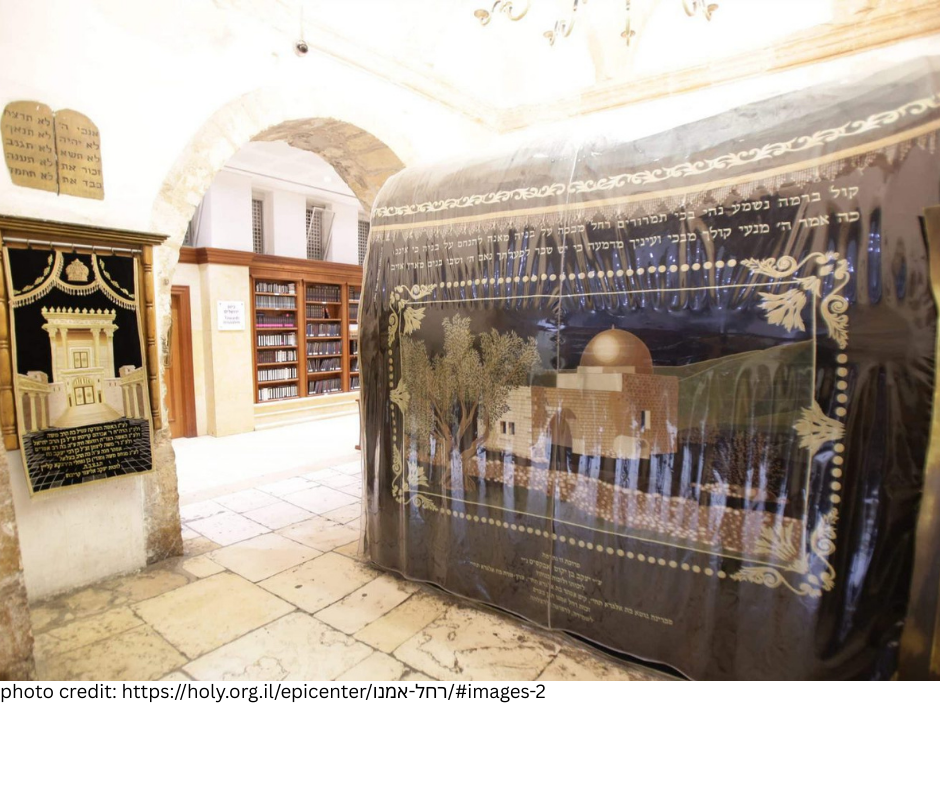
Location: Beit Lechem
Subject: Kever Rachel
Written by: David Magence
Parashat VaYishlach describes the death of Rachel Imeinu and her burial "On the road to Efrat, which is Bet Lehem." Since the times of the Talmud, tradition has identified the Tomb of Rachel at the northern end of the city of Bet Lehem.
Today, the complex around the traditional tomb is built as a fortress. The inner structure was built by Sir Moses Montefiore (1784 – 1885). The tomb of Sir Moses and Lady Judith Montefiore in Ramsgate, England is an exact replica of the structure built over Rachel's Tomb.
One does not see the actual tomb, but a cenotaph (stone marker) above the tomb. The cenotaph is covered with a cloth on which are embroidered the words of Yirmiyahu's prophecy concerning Rachel Imeinu[31:14-16]:
"So says the Lord: A voice is heard on high, lamentation, bitter weeping, Rachel weeping for her children, she refuses to be comforted for her children for they are not. So says the Lord: Refrain your voice from weeping and your eyes from tears, for there is reward for your work, says the Lord, and they shall come back from the land of the enemy. And there is hope for your future, says the Lord, and the children shall return to their own border."
Adullam
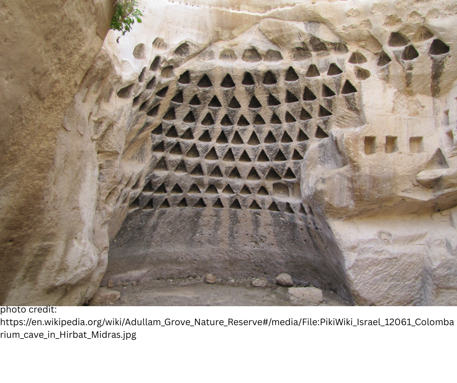
Location: Adullam
Subject: Adullam Park
Written by: David Magence
When Yehuda departed from his brothers after the sale of Yosef, he resided in the Adullam region (Bereishit Perek 38 Pousk 1).
The king of Adullam is mentioned in the list of the 31 kings Yehoshua defeated in the conquest of Eretz Yisrael (Yehoshua Perek 12 Posuk 15).
Centuries after Yehuda reached Adullam, his descendent David found refuge in the Cave of Adullam before becoming the king of Yehudah (Shmuel I Perek 22 Posuk 1). The Adullam Park contains numerous caves, most likely including the cave in which David hid.
During the Bar Kochva revolt, many of the caves of Adullam were used by Jews to hide from the Roman army.
Ein Gedi
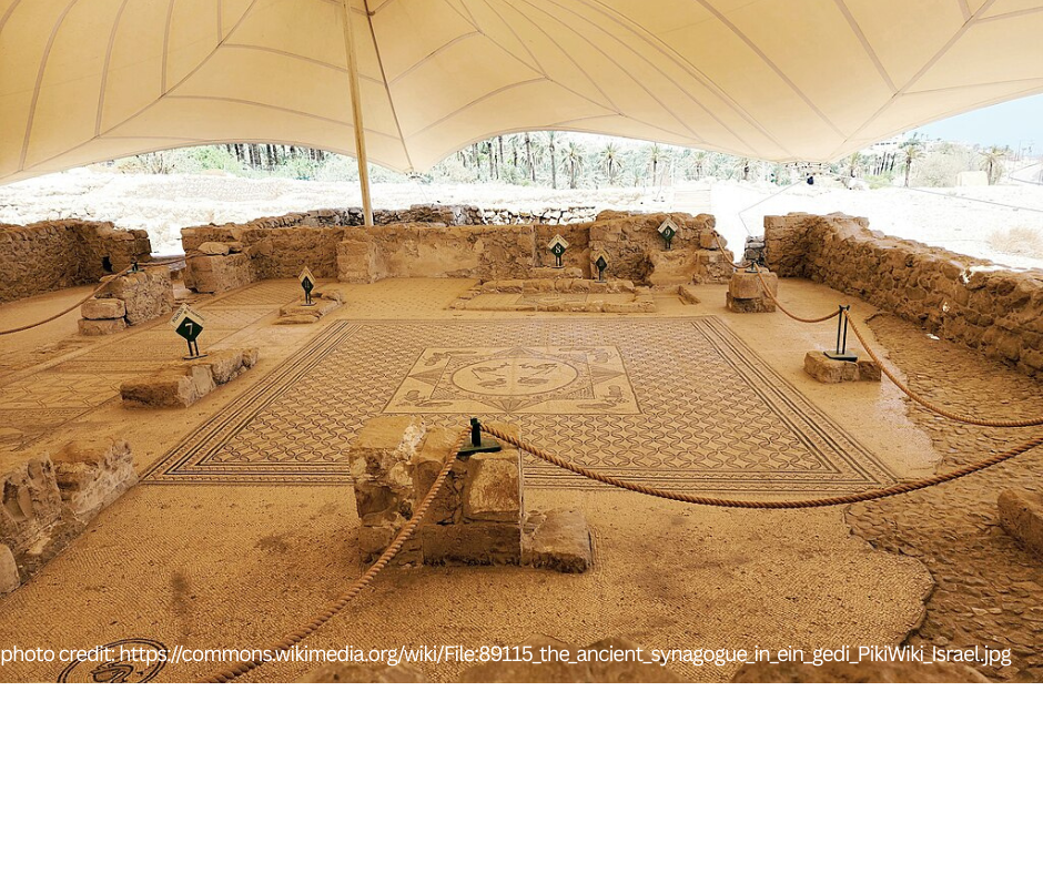
Location: Ein Gedi
Subject: Tzori
Written by: David Magence
Tzori (balm) was highly valued in the ancient world, both as a spice and for its medicinal value. Tzori was grown largely in Eretz Yisrael, specifically in Ein Gedi and Yericho.
South of the Ein Gedi Nature Reserve, archeologists uncovered the remains of an ancient synagogue. One of the mosaic inscriptions, apparently from the 5th century CE, includes a curse of anyone who "reveals the secret of the town." The suggestion is that the secret refers to the techniques of growing Tzori.
Yishuv Etz Efraim
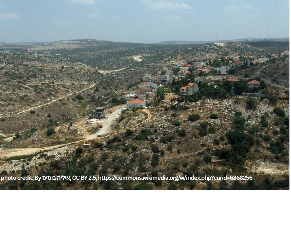
Location: Yishuv Etz Efraim
Subject: Yishuv Etz Efraim
Reference: Haftarah of Vayigash, Yechezkel Perek 37 Posuk 16
Written by: David Magence
Etz Efraim is the name of a modern Yishuv in the Shomron, which was established in 1985. The name is taken from the opening posuk of the parasha's haftarah, and was chosen both because the yishuv was established Motzaei Shabbat Vayigash and because of the fact that it is in the portion of Shevet Efraim. The population of the Yishuv is mixed, including religious and secular Jews, and perhaps this fits the prophecy of Yechezkel of unity (posuk 19).
In ancient times, the area was agricultural land in Shevet Efraim, and indeed in proximity to the Yishuv, there are remains of ancient agricultural structures, including shomerot - watch towers used for storing and protecting the agricultural produce.
Kever David
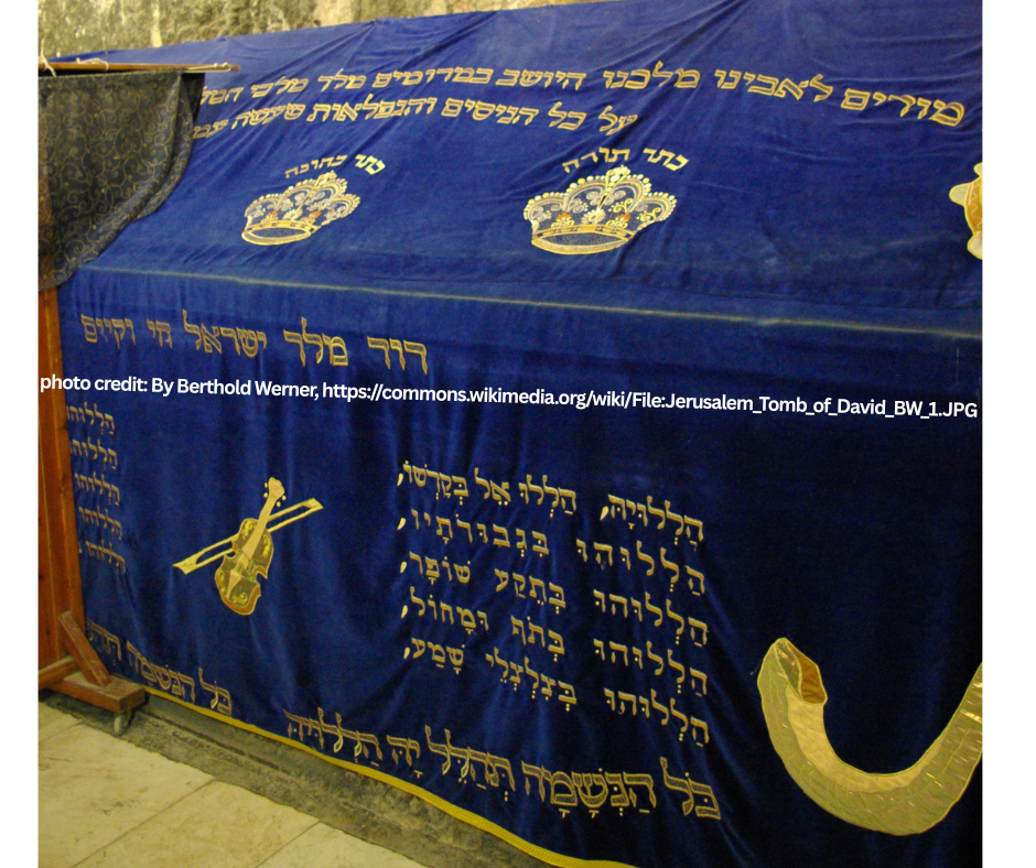
Location: Ir David
Subject: Kever David
Reference: Haftarah of Vayechi; Melachim I Perek 2 Posuk 10
Written by: David Magence
While for the last 1500 years, tradition identifies Kever David on Har Tzion, the implication of the pesukim is that David HaMelech was buried within his city, Ir David. It is clear that Har Tzion was outside the walls of Ir David.
The "first Jewish excavations in Israel" (the excavations took place in Ir David, were funded by the Rothschild family, and the head archeologist was Raymond Weil, a French Jew) uncovered remains which may be the actual Kever David.
Unfortunately, the area was used as a quarry during the Roman and Byzantine periods, and it is impossible to know with certainty what was there at the time of David HaMelech.
However, the advantage of this suggestion is that it locates Kever David within Ir David in accordance with the "peshat" (simple meaning) of the pesukim.
Today, it is possible to see these remains while touring Ir David.
Hula Nature Reserve
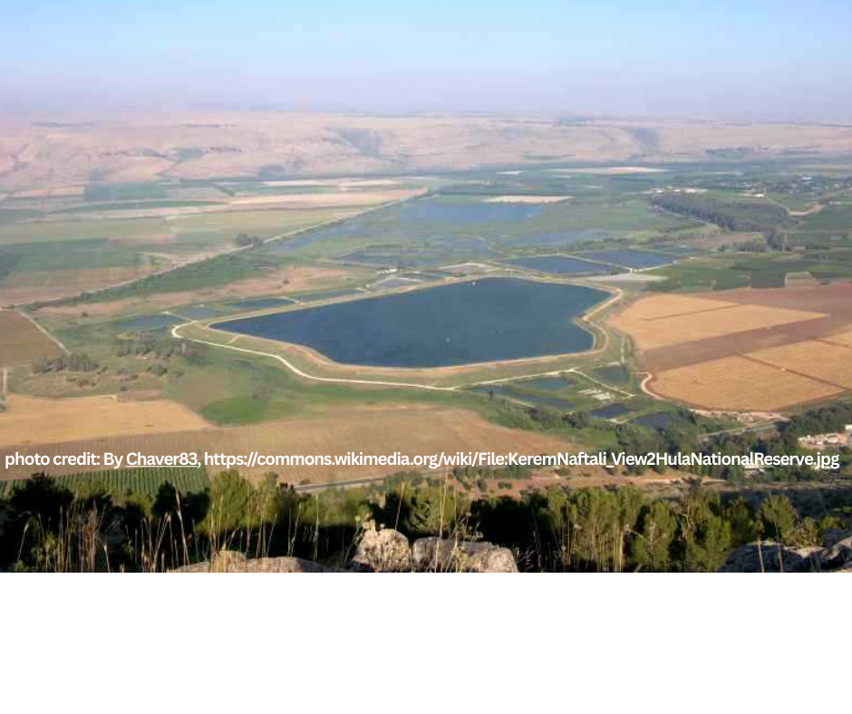
Location: Hula Nature Reserve
Subject: Papyrus (Gomeh)
Reference: Sefer Shemot Perek 2 Posuk 3
Written by: David Magence
Among the hundreds of species of Gomeh , it is accepted that Yocheved made the basket for her infant son Moshe out of papyrus.
Today, papyrus can be found in the Hula Nature Reserve, the first nature reserve established in the State of Israel in 1964. In fact, it is not truely a nature reserve, rather a reconstruction of the Hula swamps.
In the 1950's, Israel drained Lake Hula and its swamps to create agricultral land. Due to the lobbying of conservationists, it was decided to recreate swamps in a small portion of the area, and papyrus was re-planted.
Nachal Taninim Nature Reserve
Location: Nachal Taninim Nature Reserve
Subject: Taninim (crocodiles)
Reference: Sefer Shemot Perek 7 Posuk 9
Written by: David Magence
Although Rashi and other commentaries translate "tanin" as a snake, Onkelos translates "tanin" as crocodile.
While crocodiles are not found in Israel today, their memory is preserved in Nachal Taninim, which is north of Caesarea. Nachal Taninim is a perennial stream, which currently is the only non-polluted stream which flows into the Mediterranean Sea, and is named for the crocodiles which lived in the area until they were hunted into extinction. The last crocodile seen in Nachal Taninim was in 1912.
Legend (which is unconfirmed) says that the crocodiles were brought by the Romans 2000 years ago for gladiatorial combat in the nearby amphitheaters of Caesarea and Shuni.
It is possible to walk along the banks of Nachal Taninim to the point where it flows into the Mediterranean.
Kochav HaYarden National Park
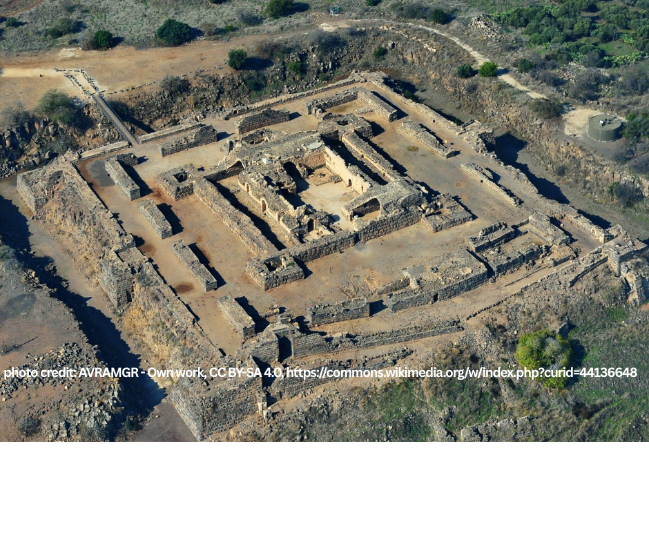
Location: Kochav HaYarden National Park
Subject: Bonfires to announce Kiddush HaChodesh
Reference: Mesechet Rosh Hashana Perek 2 Mishnayot 2-4
Written by: David Magence
Parashat Bo presents the first mitzvah which was given to Israel as a nation, Kiddush HaChodesh. In ancient times, when the Sanhedrin sanctified the new months, they would light bonfires on specific mountain tops to announce the new month (Mishna Rosh Hashana 2:2-4). In this manner, even without modern communication techniques, it was possible to inform Jewish communities not only in Israel but in the diaspora as well, that the new month had begun
The third bonfire station was known as Grofina (ibid., Mishna 4). One of the suggestions for the location of Grofina is Kochav HaYarden, which rises above the northern end of the Jordan Valley. On the slope of the mountain, there are remains of the ancient Jewish community of Kochav, which existed during the period of the Mishna and Talmud.
On the heights of Kochav HaYarden, are the remains of a Crusader fortress named Belvoir (the French translates as "Beautiful View"). Indeed, there is a beautiful view of the southern part of the Kineret and the northern portion of the Jordan Valley. Clearly, the strategic view from Kochav HaYarden is the reason Chazal (our Sages) and the Crusaders chose this hill.
While visiting the remains of the fortress, one can see that the Crusaders used stones from the remains of the Jewish community Kochav. In particular, a stone engraved with a menorah was used as part of the doorpost of the western gate of the fortress.
Laturn
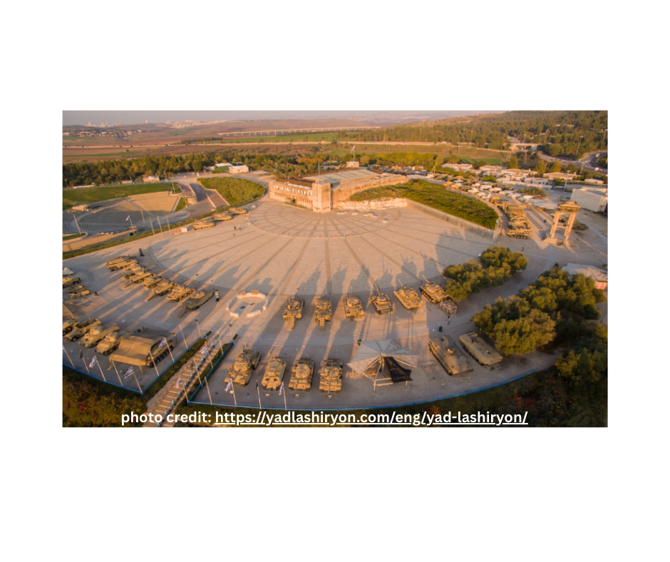
Location: Laturn
Subject: Merkava
Reference: Sefer Shemot Perek 15 Posuk 4
Written by: David Magence
The chariot is the ancient version of the modern tank. In fact, the Israeli designed and manufactured main battle tank is called Merkava (chariot).
At Laturn, the main memorial site for Israel's Armored Corps, the ancient and modern merkavot are on display; the modern merkava is an actual tank, and the ancient Egyptian and Israelite chariots are models based upon graphic evidence. The model of the Egyptian chariot is based upon a painting in an ancient pyramid, and the Israelite chariot is based upon a three dimensional depiction of the battle of Lachish during the time of the Assyrian king Sancheiriv.
Mount Herzl
Tzidkiyahu-Cave
Location: Tzidkiyahu's Cave
Subject: Tzidkiyahu's Cave
Reference: Haftara of Mishpatim; Yirmiyahu Perek 34 Posuk 21
Written by: David Magence
In the Haftara of Mishpatim, Yirmiyahu prophesied a bitter end for King Tzidkiyahu, the last king of the Davidic dynasty until the arrival of Mashiach.
In fact, as Yerushalayim was being captured by the Babylonians,Tzidkiyahu escaped the city, only to be caught in the plains of Yericho (Melachim II Perek 25 Posuk 5).
Rashi (Sefer Yechezkel Perek 12 Posuk 13) cites a tradition that Tzidkiyahu escaped through a cave, whose western end was near the royal palace and eastern end at the plains of Yericho.
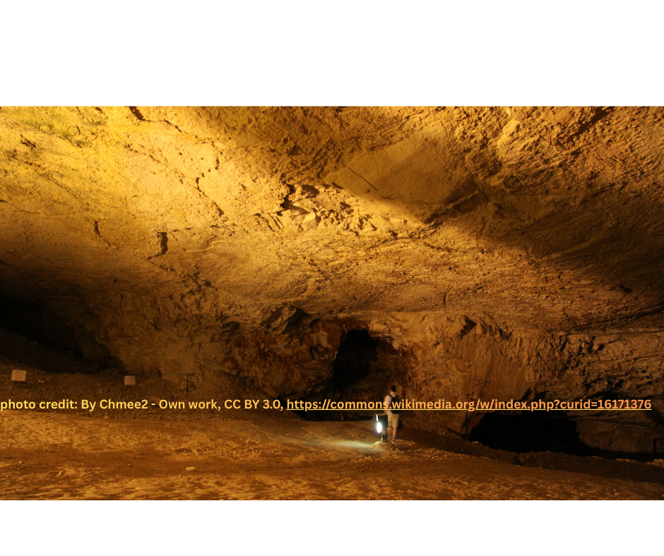
What today is called "Tzidkiyahu's Cave" is located beneath the walls of the Old City of Yerushalayim, between the Damascus gate and Herod's gate. However, since this cave has no exit, it cannot be the cave through which Tzidkiyahu attempted to escape.
In fact, the cave is a by-product of quarrying. Based upon the archeological evidence, it is clear that the quarrying was done during the Second Beit Hamikdash period. It is likely that this quarry was the major source of building stones for Herod’s expansion of Har HaBayit, including the Kotel HaMaaravi.
In fact, the cave is a by-product of quarrying. Based upon the archeological evidence, it is clear that the quarrying was done during the Second Beit Hamikdash period. It is likely that this quarry was the major source of building stones for Herod’s expansion of Har HaBayit, including the Kotel HaMaaravi.
There are differing opinions concerning the possibility that quarrying was done there during the First Beit HaMikdash period.
Tel Shilo

Location: Tel Shilo
Subject: Mishkan (Tabernacle)
Reference: Sefer Shemot Perek 26 Posuk 1
Written by: David Magence
After Am Yisrael crossed the Jordan River to enter Eretz Yisrael, the Mishkan was erected in Gilgal, where it stood during the 14 years of conquest and division of the Land.
Afterwards, the Mishkan was built in Shilo where it stood for 369 years. Unlike the Mishkan of the wilderness and of Gilgal, the Mishkan in Shilo was a stone structure without a roof, which was covered by the yeriot (curtains) which are described in Parashat Terumah.
Tel Shilo was first excavated more than a century ago, and the excavations have been renewed and are ongoing. At the northern end of the Tel, there is a flat area carved out of the rock, whose dimensions accomodate the Mishkan and its courtyard, and is therefore assumed to be the actual site of the Mishkan.
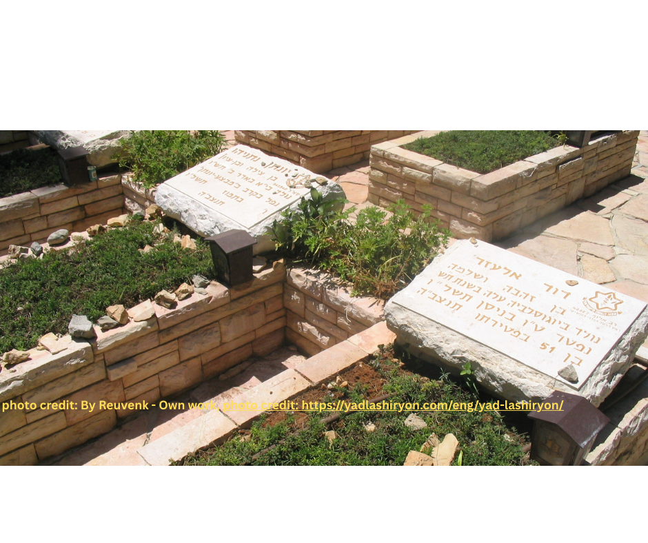
Radar Hill
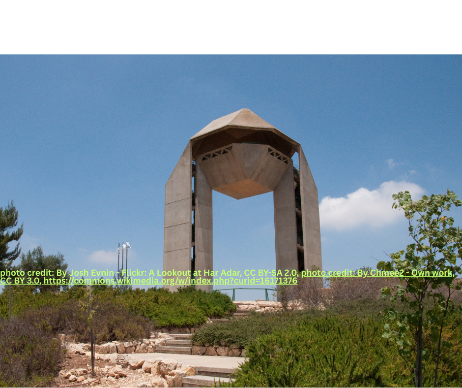
Location: Radar Hill (Har Adar)
Subject: Harel Brigade Monument
Reference: Sefer Yechezkiel Perek 43 Posuk 15 (Haftora of Tezaveh)
Written by: David Magence
The Haftara of Tetzaveh (when the parasha does not coincide with Shabbat Zachor) refers to the "Harel", which is generally translated as the "hearth" of the altar, though Rashi defines it as the top of the mizbeach. Ibn Ezra comments that "Harel" is one of the names of Yerushalayim.
During the War of Independence, the Palmach, the elite unit of the Hagana, established the Harel Brigade. The name was chosen because the brigade was designated to fight in the Yerushalayim area.
Radar Hill, so named because the British built a radar facility there, is one of the strategic hills controlling the approach to Yerushalayim.
In the War of Independence, the Harel Brigade attacked but failed to liberate Radar Hill.
During the Six Day War, the Harel Armored Brigade succeeded in liberating the Hill.
Today, one can visit the Harel Brigade Monument at Radar Hill, seeing remains of the Jordanian trenches and bunkers and Israeli tanks and armored vehicles which overcame those fortifications. Climbing up to the top of the monument affords a beautiful view of the approach to Yerushalayim and conveys the strategic importance of the hill.
The Archaeological Park - Davidson Center
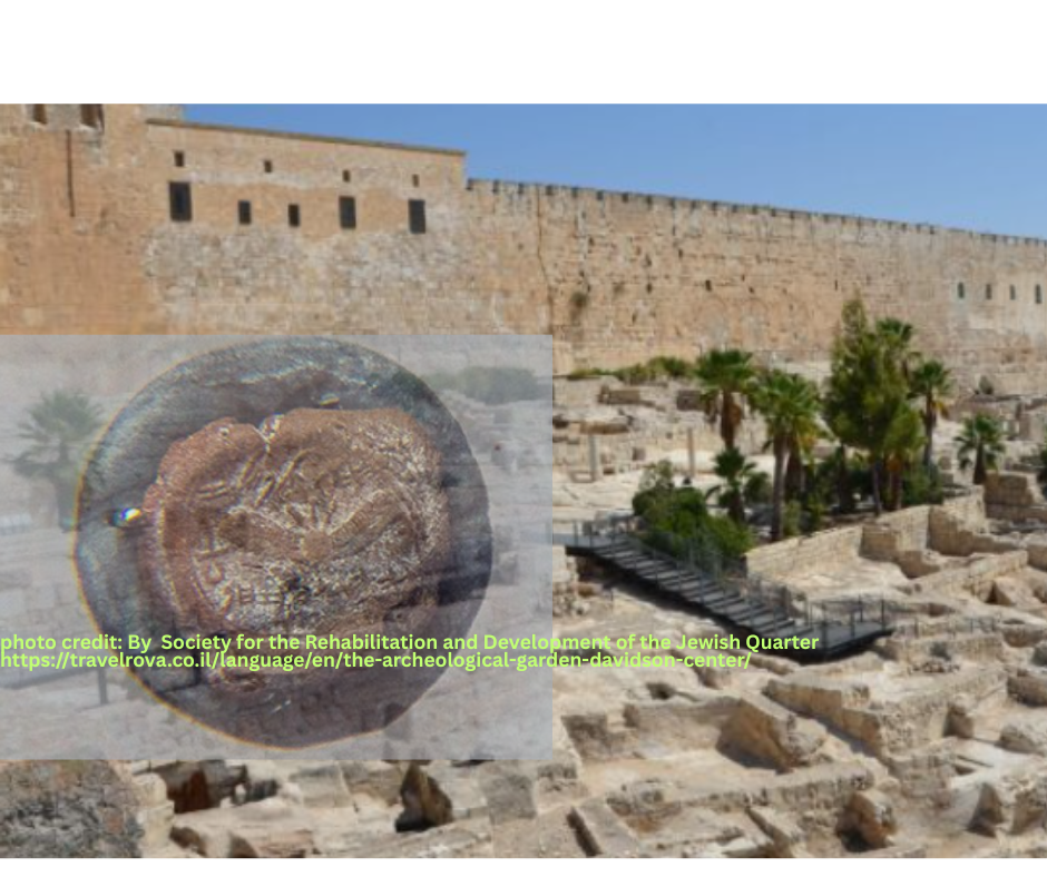
Location: Davidson Center
Subject: Machatzit Hashekel
Reference: Sefer Shemot: Perek 30 Posuk 13
Written by: David Magence
The Archeological Garden-Davidson Center includes the excavations of the Southern end of Har Habayit (Temple Mount) from the Herodian period. Archeologists uncovered remains of the Southern Wall of Har HaBayit as well as the Southern part of the Kotel HaMaravi, along which they exposed the entire width of the Herodian street, which ran parallel to the Kotel HaMaravi. Leading up to the Southern wall of Har Habayit, the ancient staircase which lead to two gates was also uncovered. Among the artifacts discovered in the excavations were half-shekel coins. These coins are now on display in the Davidson Center. Based upon the Talmudic understanding of Parashat Ki Tisa, the half-shekel coins were used to purchase korbanot tzibur (public sacrifices), as well as for maintenance of the Beit HaMikdash.Eshel HaShomron Hotel
Location: Eshel HaShomron Hotel, Ariel
Subject: Mishkan (Tabernacle)
Reference: Sefer Shemot Perek 35 Posuk 11-18
Written by: David Magence
The Eshel Hashomron Hotel, the only Jewish owned hotel in Samaria, has a biblical garden, which presents scenes from Tanach, from the Avot through Eliyahu Hanavi.
The highlight of the biblical garden is a full-sized replica of the Mishkan, including the courtyards and the vessels of the Mishkan.
In accordance with the Torah's description, the Mishkan itself is divided into the Kodesh (Holy) and Kodesh Kodashim (Holy of Holies). Within the Kodesh are replicas of the Menorah, Shulchan and Mizbeach Haketoret. Within the Kodesh HaKodashim, is a replica of the Aron HaBrit.
Gei Ben Hinom
Location: Gei Ben Hinom (opposite Birkat HaSultan [the Sultan's Pool])
Subject: Gei Ben Hinom
Reference: Haftorah of Parashat Tzav, Yirmiyahu Perek 7 Pesukim 31-32
Written by: David Magence
As Yirmiyahu makes clear, Gei Ben Hinom was a place where child sacrifice was practiced. While the Torah abhors any form of idolatry, child sacrifice is the ultimate evil.
Therefore, in pasuk 32, Yirmiyahu prophesizes that the valley will be known as "Gei HaHarayga" ("Valley of Killing," in Hebrew a play on words of Gei Ben Hinom).
Gei Ben Hinom is mentioned in Tanach also as a point on the border between the tribes of Binyamin and Yehuda (Sefer Yehoshua Perek 15 pasuk 8).
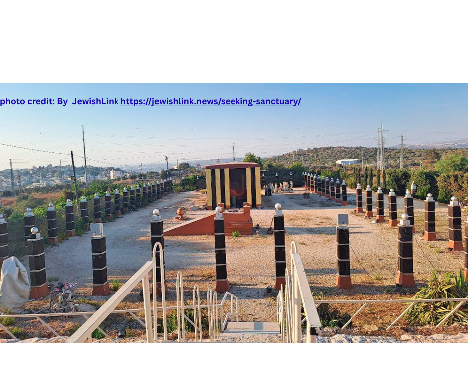
מגילת האש
Location: Megilat HaEish (Scroll of Fire)
Subject: Navi Yechezkel's prophecy of the Valley of the Dry Bones
Sefer Yechezkel Perek 37 Pesukim 1-14
Written by: David Magence
The haftarah of Shabbat Chol HaMoed Pesach is the Navi Yechezkel's vision in the Valley of the Dry Bones. (Years in which Pesach begins Motzaei Shabbat, there is no Shabbat Chol HaMoed). In the prophecy, the Navi Yechezkel saw dry bones coming together and being brought back to life. The pinnacle of the prophecy is HASHEM's instruction to Yechezkel to tell Am Yisrael: "I open your graves and bring you up from your graves and bring you home to the Land of Israel". The Scroll of Fire, a magnificent sculpture located in the Martyr's Forest, tells the story of recent Jewish history, from the Shoah (Holocaust) to the establishment of the State of Israel and the reunification of Yerushalayim. The posuk which adorns the sculpture is the posuk quoted above. A recurring theme of the sculpture is the mother and child, who together survive the Holocaust to be privileged to ascend to the Land of Israel and to eat of the fruit of which the Torah praises the Land. The sculpture, the work of the late Natan Yaakov Rapaport, presents a view of Jewish history based upon the sincere belief that it is guided by HASHEM Himself.
Katzrin Talmudic Village

Location: Katzrin Talmudic Village
Subject: Tanur and Kirayim (the ancient stove and oven)
Reference: Sefer Vayikra Perek 11 Posuk 35
Written by: David Magence
On the outskirts of the modern town of Katzrin in the Golan Heights, archeologists excavated the remains of a Jewish agricultural village dated to the Talmudic period.
Some of the homes excavated have been partially reconstructed and replicas of ancient tools and household furnishings have been added.
In the courtyard of one of the reconstructed homes, one can see the reconstructed "tanur" (oven) and "kirayim" (stove) in Parashat Shemini.
The village also holds the remains of an ancient synagogue, or more exactly, a number of synagogues built on the same site over the course of several centuries.
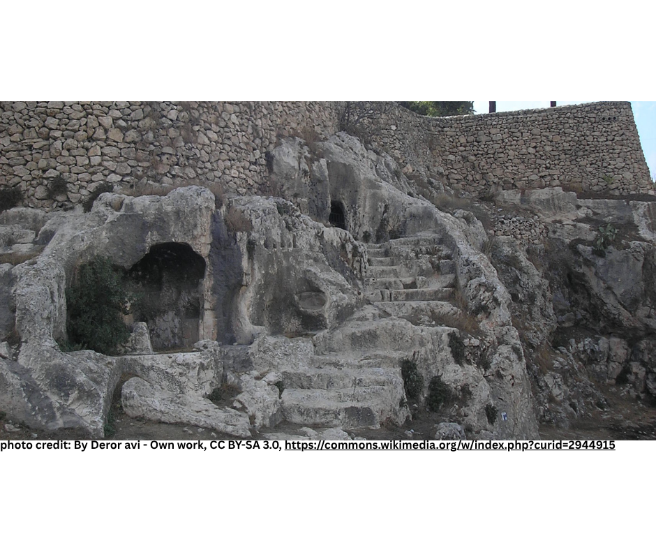
Tomb of the Chezir Family of Kohanim
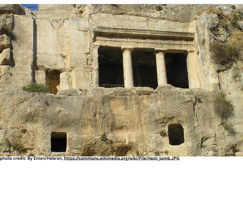
Location: Tomb of the Chezir Family of Kohanim
Subject: Beit HaChofshit
Reference: Sefer Vayikra Perek 13, Divrei HaYamim II Perek 26 Posukim 20-21
Written by: David Magence
The 13th perek of Vayikra details the laws of Tzara'at. Among the biblical figures who were metzoraim, is Uziyahu, King of Yehudah as mentioned in Divrei HaYamin II Perek 26 Posukim 20-21. Torah Law, as mentioned in Sefer Bamidbar Perek 5 Posuk 2 (see Rashi's comments) requires a Metzora to remain outside the Three Camps (Shechina, Leviim, Yisrael). Since all of the walled city of Yerushalayim is Machaneh Yisrael, Uziyahu had to leave his capital, Yerushalayim. Since Uziyahu was not cured of Tzaraat, "until the day of his death", he resided in Beit HaChofshit. Popular Tradition, identifies the location of Beit HaChofshit as the Tomb of the Chezir family of Kohanim, on the western slope of Har Hazeitim, above the Kidron Valley. Since the burial cave was prepared during the Period of the Chashmonaim, hundreds of years after the death of King Uziyahu, the cave itself obviously cannot be Beit HaChofshit. Perhaps the identification is based upon a tradition that Beit HaChofshit was located in this area. Given that the Kidron Valley is the obvious natural eastern boundary of Yerushalayim, it is reasonable to assume that King Uziyahu crossed the Kidron Valley and therefore by definition was "outside" of Yerushalayim, yet close to the Holy City.
Institute for Torah and the Land of Israel
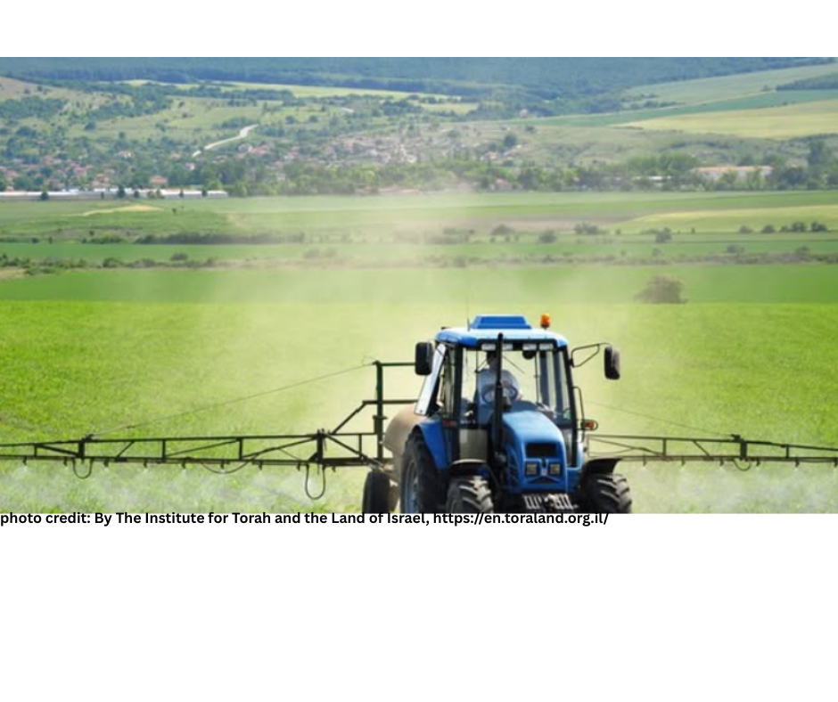
Location: The Institute for Torah and the Land of Israel
Subject: Mitzvot Hateluyot BaAretz (Mitzvot dependent on the Land)
Reference: Sefer Vayikra Perek 19 Pesukim 23-25
Written by: David Magence
The Institute for Torah and the Land of Israel was established more than 30 years ago in Gush Katif. With the expulsion of the Jewish communities from Gush Katif, the Institute was forced to move to different locations and as of last year its current permanent location is in Nitzan, between Ashdod and Ashkelon.
The Institute's activities include research and education concerning the practical connection between Torah and Eretz Yisrael within the contemporary State of Israel.
The Institute's visitors' center offers an interactive program which deals with the challenges of modern agriculture in accordance with Halacha.
In addition, the Institute organizes halacha-and-agriculture tours throughout the Negev in English and Hebrew for hands-on learning about mitzvot which are connected specifically to the Land of Israel.
Kibbutz Revadim
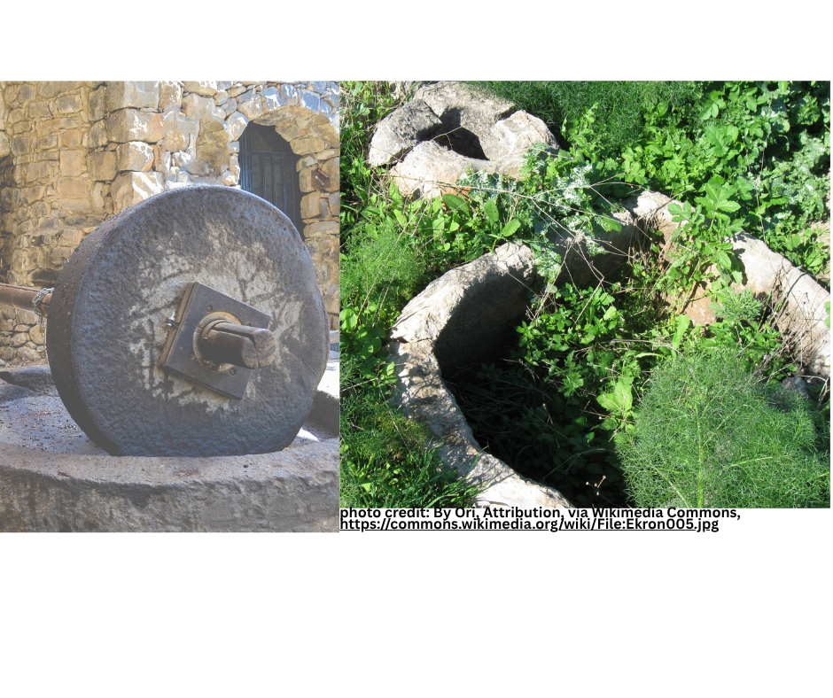
Location: Kibbutz Revadim
Subject: Olive Oil
Reference: Sefer Vayikra Perek 24 Posuk 2
Written by: David Magence
Olives are among the seven species for which the Torah praises Eretz Yisrael.
Among the numerous places in Israel where ancient olive presses have been discovered is in the fields of Kibbutz Revadim, where remains of more than 100 olive production facilities, dated to the Biblical period, have been uncovered.
It is estimated that these ancient facilities had the capacity to produce more than 1 million liters (290,000 gallons) of olive oil per year.
The kibbutz has a museum dedicated to the history of the Biblical city of Ekron, whose site is within the kibbutz's fields. The museum offers a hands-on activity of producing olive oil as it was done in ancient times.
Tel Megiddo National Park
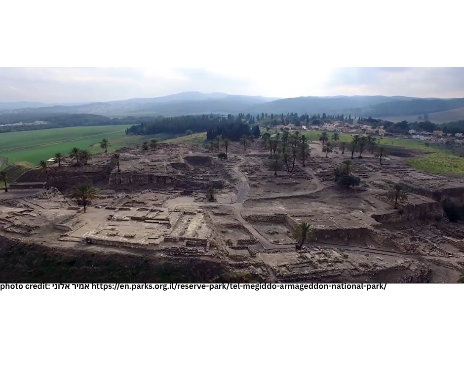
Location: Tel Megiddo National Park
Subject: King Yoshiyahu's battle against Pharaoh Necho at Megiddo
Reference: Sefer Vayikra Perek 26 Posuk 6 Rashi's quote of the Midrash Torat Kohanim
Written by: David Magence
In Parashat Bechukotai (Perek 26 Posuk 6) Hashem promises that when Am Yisrael fulfills the mitzvot, "I will provide peace in the Land … and no sword will pass through your Land". Rashi quotes Midrash Torat Kohanim, which states that not only will there be no war in the Land, but armies will not even pass through the Land.
The promise as understood by the Midrash corresponds to the geographic reality of the Land, which is the natural land-bridge between the two centers of ancient civilizations, Egypt and Mesopotamia.
Napolean Bonaparte described Israel as "the guardian of Africa, the gate to Asia."
This reality cost the life of King Yoshiyahu as described in Melachim II Perek 23 Pesukim 29-30, and Divrei HaYamim II Perek 35 Pesukim 20-25. Pharoah Necho marched his army through the kingdom of Yehuda in order to battle the Babylonians. Against the advice of Yirmiyahu HaNavi, King Yoshiyahu went to battle Pharoah Necho in order to preserve the sovereignty of his kingdom, and was killed in the battle of Megiddo.
The Israel National Parks Authority advertises Tel Megiddo as "the crown jewel of Biblical archeology," and the tel is recognized as a World Heritage Site.
The excavations at Tel Megiddo uncovered 20 separate levels of settlements, including the biblical periods. Among the remains are the Israelite Gate, stables for horses that were used to pull the chariots and the ancient water system.
Tel Shikmona
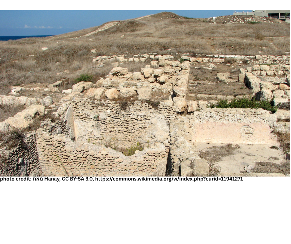
Location: Tel Shikmona (southern entrance to Haifa)
Subject: Argaman (The Royal Purple)
Reference: Sefer Bamidbar Perek 4 Posuk 13
Written by: David Magence
The reason that argaman is called “Royal Purple” is the fact that in ancient times, only the wealthy could afford it.
Modern research indicates that thousands of mollusks had to be gathered in order to produce even small amounts of the dye.
Another feature of the argaman is that, chemically, it is fire retardant. Since our Sages teach that the fire of the altar was not extinguished when the Mishkan was moved, the fire-retardant property of argaman was significant in preventing the fire of the altar from spreading. This is the reason that the mizbeach was covered specifically with a cloth of argaman, as described in our pasuk.
At Tel Shikmona, archaeologists uncovered remains of an industrial facility for producing argaman from the murex snail. This facility dates to the First Temple Period.
Rechov HaChatzotrot
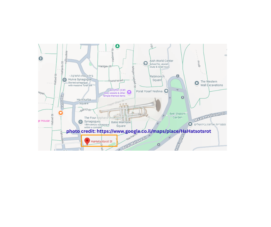
Location: Rechov HaChatzotrot, Jewish Quarter, Jerusalem
Subject: Chatzotrot
Reference: Sefer Bamidbar Perek 10 Pesukim 1-10
Written by: David Magence
The alleyways of the Jewish Quarter were named to reflect Jerusalem's period of greatest glory, when the Beit HaMikdash stood.
Paying attention to the significance of the names of the alleyways in essence is taking a tour of traditional Jewish sources.
Among the alleyways is Rechov HaChatzotrot. This alleyway is perpendicular to Rechov Mishmarot HaKehuna (the groups of Kohanim who served in the Beit HaMikdash), which is significant, since Chatzotrot were played specifically by Kohanim.
At the Temple Institute, a short walk from Rechov HaChatzotrot, one can see what Chatzotrot looked like.
HaMizgaga Museum of Archaeology and Glass
Location: HaMizgaga Museum of Archaeology and Glass, Nachsholim (North of Zichron Yaakov)
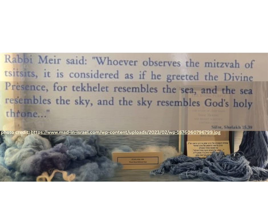
Subject: Techelet
Reference: Sefer Bamidbar Perek 15 Posuk 38
Written by: David Magence
Wool dyed techelet was used extensively in the Mishkan and the garments of the Kohen Gadol.
Rabbi Isaac haLevi Herzog, the second chief rabbi of Israel (1937- 1959) wrote his doctoral dissertation on identifying the source of Techelet. The secrets of techelet were lost for more than one-thousand years, and in recent years researchers have rediscovered those secrets.
Today, one can visit HaMizgaga Museum of Archaeology and Glass, Nachsholim, and see and learn about Techelet.
Timna Park
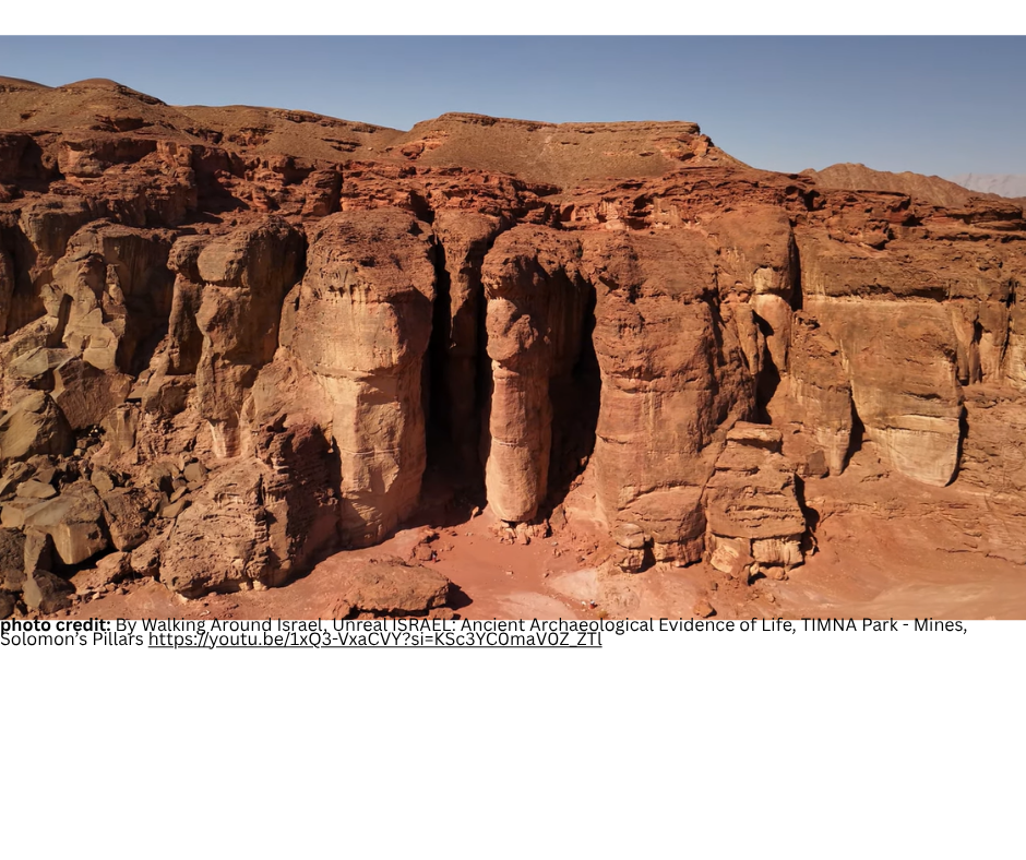
Location: Timna Park
Subject: Solomon's Mines
Reference: Sefer Bamidbar Perek 17 Posuk 4
Written by: David Magence
The copper machtot (fire-pans) of Korach's 250 co-conspirators were made into a cover for the mizbeach.
Timna Park, approximately 25 kilometers north of Eilat, holds the remains of ancient copper mining and smelting facilities. Based on the archeological evidence, these are the earliest copper mines in the world.
More importantly for us, the Park includes the remains of King Solomon's mines. Timna Park covers approximately 60 square kilometers.
In addition to the archelogical sites, there is a variety of geological formations, a technologically advanced vistors' center, more than 20 hiking trails and an artifical lake.
Tel Arad
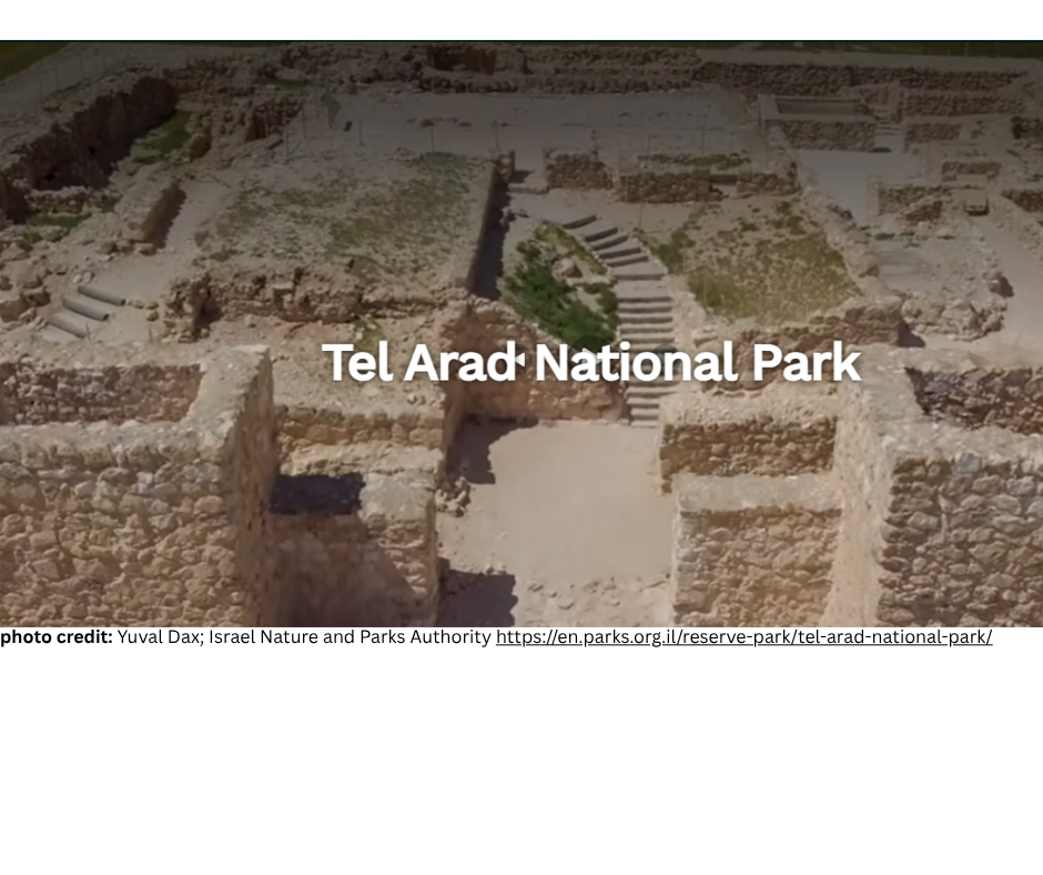
Location: Tel Arad
Subject: Bibilical Arad
Reference: Sefer Bamidbar Perek 21 Pesukim 1-3
Written by: David Magence
Tel Arad, presumably the site of biblical Arad, is located approximately eight kilometers west of the modern city of Arad.
Excavations have uncovered remains of a walled Canaanite city, as well as later remains from the period of the kingdom of Yehudah.
These remains occupy the higher part of the Tel, and include remains of an Israelite fortress which was used between the 9th and 6th Centuries BCE to protect the kingdom of Yehudah's southern border.
Gush Etzion Visitor Center
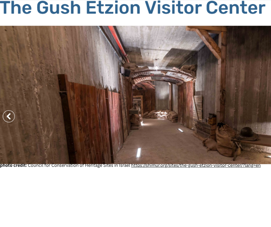
Location: Gush Etzion Visitor's Center, Kfar Etzion
Subject: Rosh Tzurim
Reference: Sefer Bamidbar Perek 23 Posuk 9
Written by: David Magence
Kibbutz Rosh Tzurim, whose name is taken from Bilam's blessing, is located in Gush Etzion, and occupies the land of the original Kibbutz Ein Tzurim, which was established shortly before Rosh Hashana 5707 (September 23, 1946).
Prior to Israel's Independence, Ein Tzurim was one of the four kibbutzim comprising the Etzion Bloc. The defenders of Ein Tzurim were forced to surrender to the Arab Legion the day Israel's Independence was declared; and were sent to Jordan as prisoners of war.
Until the Six Day War, the area was not accessible to Jews. In 1969, Rosh Tzurim was established on the site of the original Ein Tzurim.
The Gush Etzion Visitor Center presents the history of Jewish settlement in the Gush Etzion area, starting with the establishment of Migdal Eder in 1927 through the re-establishment of Jewish settlement following the Six Day War.
Mitzpe Gadot
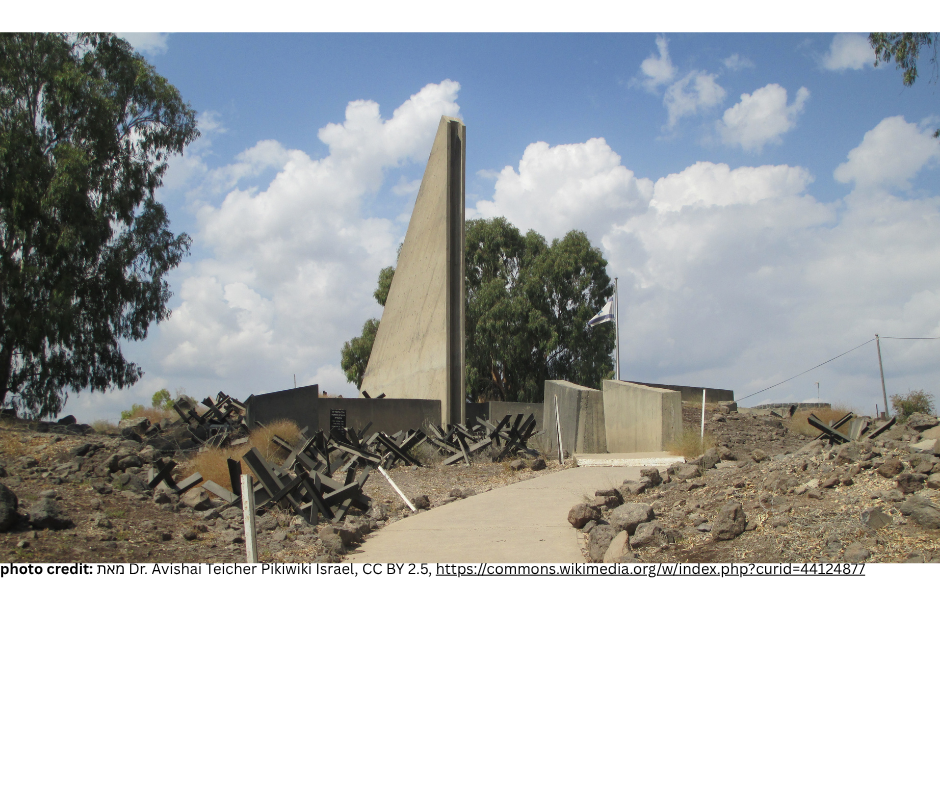
Location: Mitzpe Gadot (Golan Heights)
Subject: Paradigm of Israelite Military Leadership - "Follow Me"
Reference: Sefer Bamidbar Perek 27 Posuk 17 Rashi
Written by: David Magence
When Hashem told Moshe Rabbeinu to prepare to die, he responded as a true leader, asking Hashem to appoint as his replacement a leader "who will go before the Nation and come before them, who will lead them out and bring them in."
Rashi quotes the Midrash that Moshe said: "Not like the kings of the nations, who sit at home and send their armies to war, but as I myself did, fighting against Sichon and Og."
This approach is followed by Zahal (IDF), where the battle cry is "Acharai" (Follow me). As a result of this approach, there is always a high percentage of casualties sustained by officers.
Among the many memorial sites for our fallen soldiers, the monument at Mitzpe Gadot which was a Syrian military position which dominated Kibbutz Gadot, and from which the kibbutz was shelled numerous times, lists the fallen soldiers' ranks. One can see that there is a significant percentage of officers who fell in battle in the Golan Heights in the wars protecting the Jewish State.
Bashan Gloan Heights
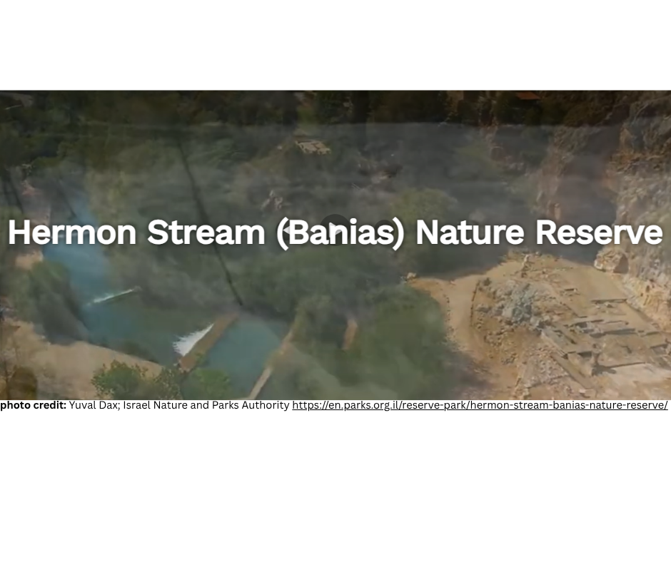
Location: Bashan (Gloan Heights)
Subject: Banias Nature Reserve
Reference: Sefer Bamidbar Perek 32 Posuk 33
Written by: David Magence
What we now call "Golan" was the western part of the biblical Bashan, which was captured by Israel from the giant King Og as described in Parashat Chukat (Sefer Bamidbar Perek 21 Pesukim 33-35).
In fact, in biblical terms, Golan was a city within the Bashan, and was the northern most of the three Arei Miklat (Cities of Refuge) on the eastern side of the Jordan River.
Among the sites to visit in the Golan is the Banias Nature Reserve, which includes one of the three sources of the Jordan River. Our Sages' tradition (Masechet Bava Batra 74b) is that the Jordan River flows from the Banias Cave. Today, the water does not flow directly from the cave. Some suggest that this is the result of earthquakes, which altered the course of the water. Another suggestion is that the Sages' intent is that the origin of the river is near the cave. The Banias water is chilly year-round, due to the fact that its source is the melted snow of Mount Hermon.
Within the Banias Nature Reserve, there are a number of hiking trails, one of which leads to the remains of the palace of King Agrippa II, which was built almost 2000 years ago.
Mount Hermon
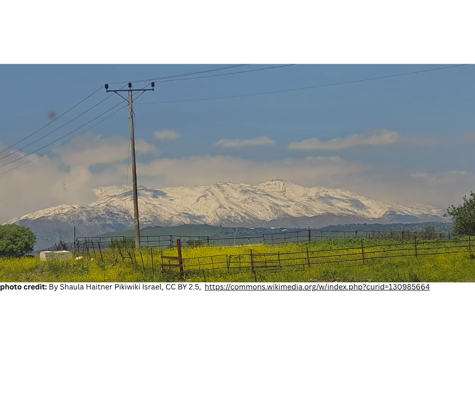
Location: Mount Hermon
Subject: Mount Hermon
Reference: Sefer Devarim Perek 3 Posuk 8
Written by: David Magence
Mount Hermon, with its peak 2814 meters (9232 feet) above sea level, is the highest point in Israel.
The heights of the Hermon provide the Israel Defense Forces with strategically invaluable observation posts, from which it is possible to monitor military activity in Lebanon and Syria.
Interestingly, Sefer Yehoshua (Perek 11 Posuk 3) refers to: "under Hermon in the land of Mitzpah". Freely translated, "the land of Mitzpah" would be "observation land", which is what Mount Hermon is for Israel.
Because of its elevation, Mount Hermon receives significant snowfall, and its peaks are covered with snow much of the year. It is noteworthy that in Aramaic, Mount Hermon is called "Tur Talga", Snow Mountain.
Moshav Neve Ativ, located on the slope of Mount Hermon, operates the Hermon ski resort which offers the only snow skiing in Israel.
Qumran National Park
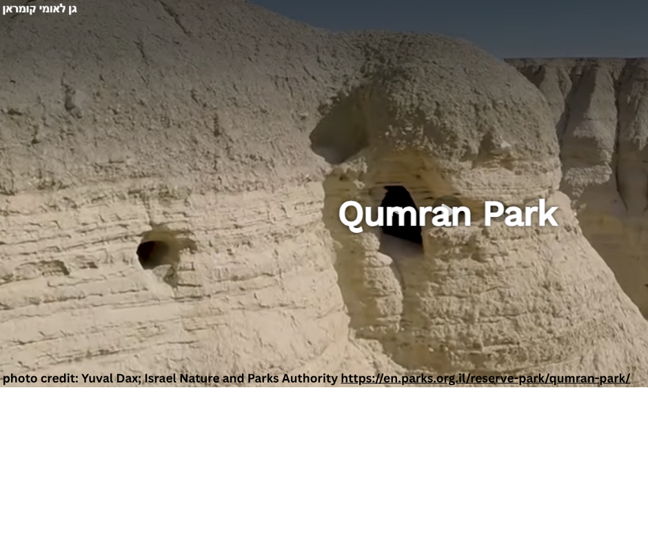
Location: Qumran National Park (northern end of the Dead Sea)
Subject: Dead Sea Scrolls
Reference: Sefer Devarim Perek 4 Posuk 49
Written by: David Magence
The "Arava" is mentioned in Chumash four times, twice in Parashat Devarim and twice in Parashat Ve'atchanan.
In modern terms, the boundaries of the "Arava" are defined as from the southern end of the Dead Sea (in our posuk "the Sea of the Arava") to the Gulf of Eilat.
However, it is clear that Tanach's definition of the boundaries is much broader, beginning at the southern end of the Kinneret. Our posuk deals with the eastern Arava, however, the western Arava presents significant sites.
The Qumran National Park is located opposite the northern end of the Dead Sea, and includes caves in which the Dead Sea Scrolls were found, as well as the remains of the ancient village of Qumran.
The Dead Sea Scrolls include at least a fragment of every book of Tanach, except for Megilat Esther. The scrolls were written by the Essene Sect, which differed from the Perushim, and did not accept the Oral Law.
Nonetheless, the scrolls are of great importance, since they were written approximately two thousand years ago. Prior to the discovery of the scrolls, the oldest manuscript of the Tanach was only about one thousand years old.